|
|
 |
| |
 |
Gefietste
routes in de Pyreneeën  Our cycle trips in the Pyrenees
 |
| |
|
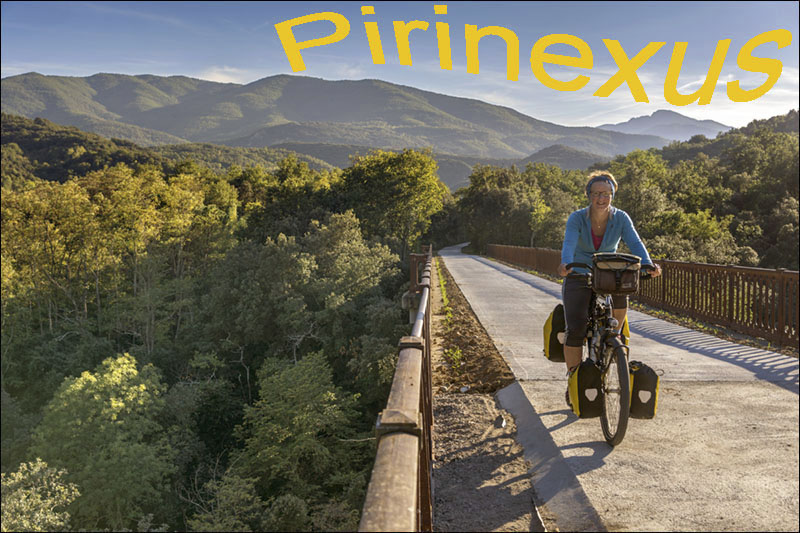
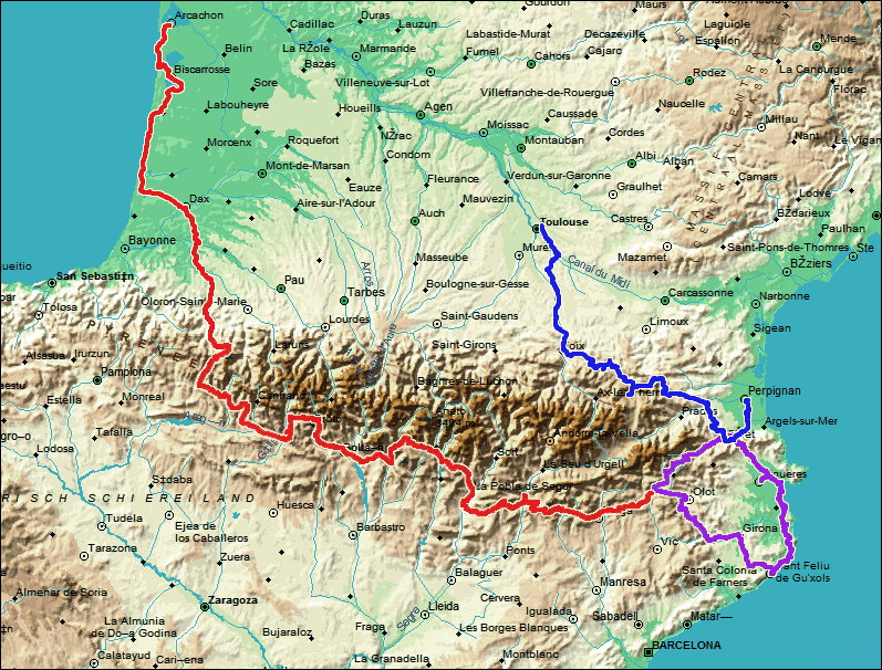
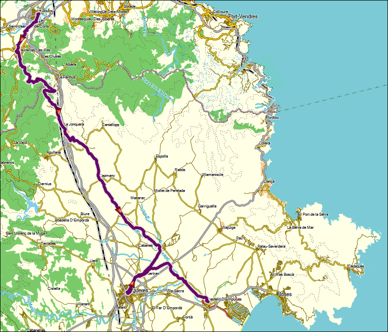
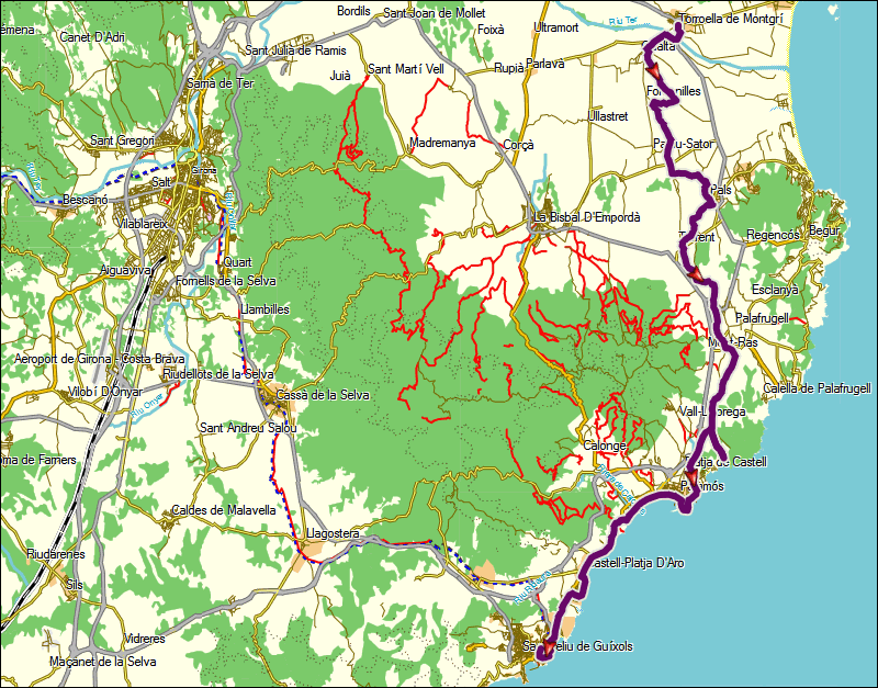
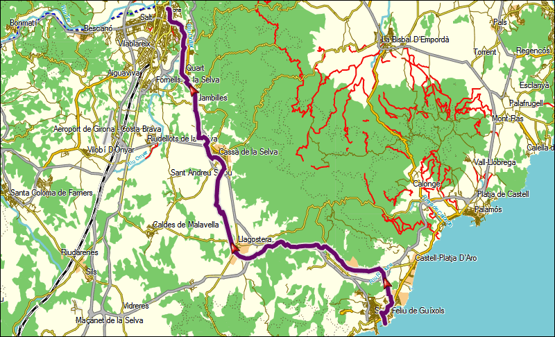
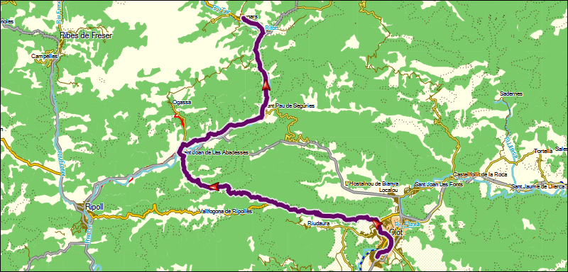
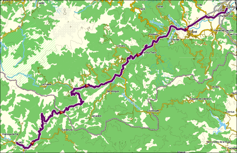
Pirinexus |
|
Olot-Arcachon |
|
Perpignan-Toulouse |
| |
|
|
(wordt later toegevoegd)
(will be added later) |
|
(wordt later toegevoegd)
(will be added later) |
|
| |
 |
Hoogteprofiel
Pirinexus
Elevation profile Pirinexus |
| |
dag
1 |
van |
naar |
afstand |
netto
fietstijd
|
totale
klim
|
gemiddelde
stijging
|
wegdek |
verkeers-drukte |
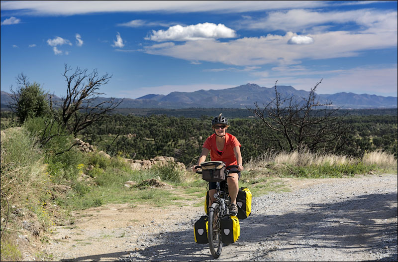
06-10-13 |
Le
Boulou |
Castello
d'Empuries |
70
km |
5:10
h |
745
m |
4
% |
meestal
grind |
rustig |
day
1 |
from |
to |
distance |
moving
time |
total
ascent |
average
up-hill gradient |
road
surface |
traffic
intensity |
06-10-13 |
Le
Boulou |
Castello
d'Empuries |
70
km |
5:10
h |
745
m |
4
% |
mainly
gravel |
quiet |
|
| |
 |
| |
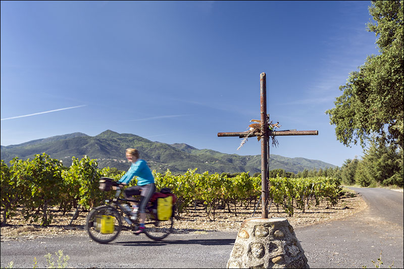 |
| Achter wijnvelden lonken de
Pyreneeën
Pyrenees emerge behind vineyards |
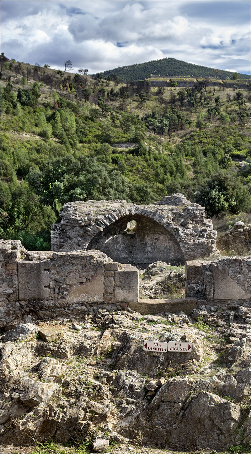 |
Op de amper 400 meter hoge Col
de Panissars passeren we een Romeinse grenspost tussen Gallië
en Spanje
At the Col de Panissars, less than 400 metres high, we find
a Roman border post between Gaul and Spain |
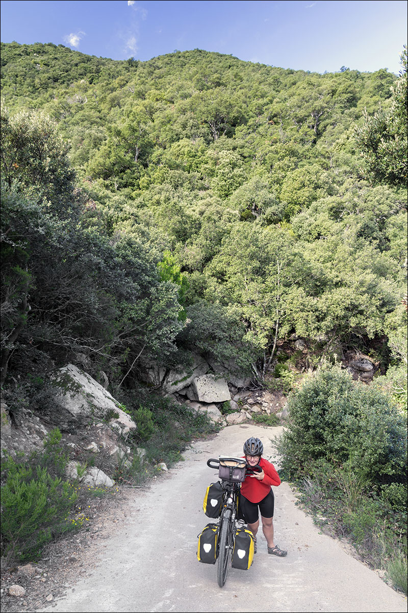 |
Na de Col de Panissars slingeren
we omlaag op een hobbelig grindpad met nog drie korte venijnige
klimmetjes
Downhill from Col de Panissars is a rough and winding
gravel road, including three short but very steep climbs |
 |
We picknicken voor een poort
tussen de steeneiken. De eigenaar moet wel een fan zijn van
Gaudí en Dalí
We have a picknick in front of a gate, surrounded by holm
oaks. The owner must be a fan of Gaudí and Dalí |
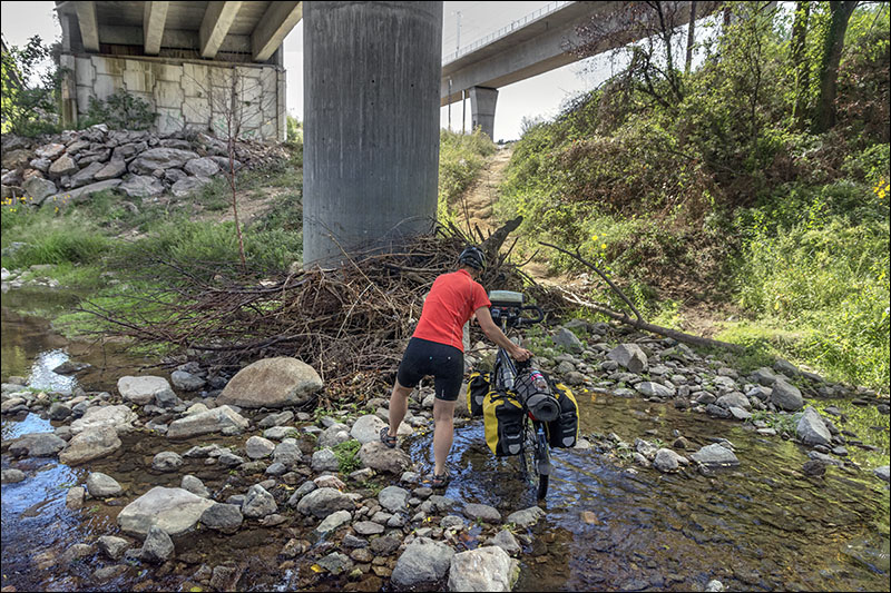 |
Onder de snelweg bij La Jonquera
ontbreekt een fietsbrug. Een geitenpad leidt naar een beek waar
we doorheen moeten waden. De Pirinexusgids meldt laconiek: 'Dit
is de bescheiden prijs die we moeten betalen om de stad te bereiken
via een ontspannen route, ver weg van het gevaar en de herrie
van het snelverkeer'. Het alternatief is vanaf de Col de Panissars
naar Perthus fietsen en verder over de drukke N11 naar La Jonquera
A cycle bridge is missing under the motorway to La Jonquera.
A rough track leads to a small river we have to wade through.
The Pirinexus guide puts mildly: 'This is the small price we
have to pay to be able to reach the town via a relaxed route
which is far removed from the dangers and noises of motorised
vehicles'. The alternative is to cycle from the Col de Panissars
to Perthus and then follow the busy N11 to La Jonquera. |
 |
Op weg naar Capmany genieten
we van het uitzicht op een bijna Afrikaans landschap
On the road to Capmany we enjoy the views of a landscape
that is almost African |
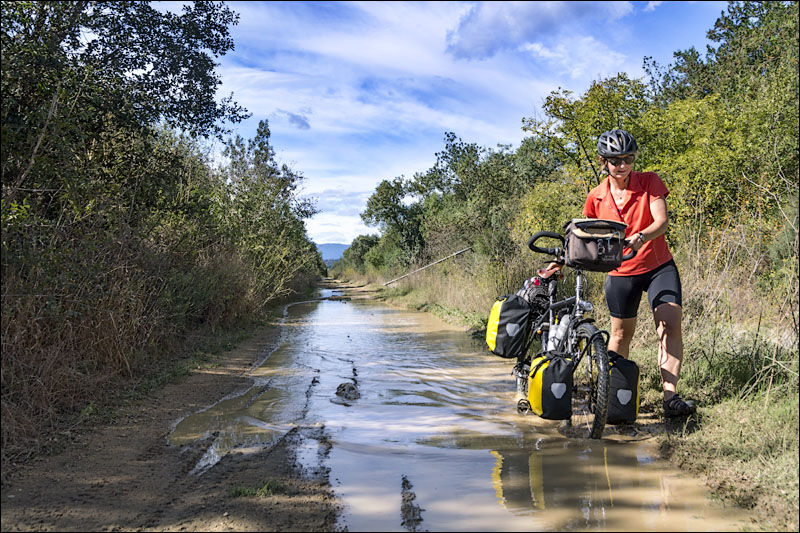 |
| Plassen op de weg verraden dat
het al oktober is
A flooded road reminds us it is already October |
 |
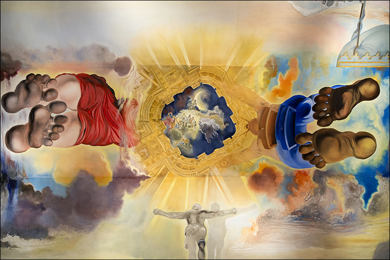
We maken een ommetje via Figueres
om het Dalí Theatermuseum te bezoeken 
We make a small detour to Figueres to visit the Dalí
Theatre-museum |
 |
| |
dag
2 |
van |
naar |
afstand |
netto
fietstijd
|
totale
klim
|
gemiddelde
stijging
|
wegdek |
verkeers-drukte |
07-10-13 |
Castello
d'Empuries |
Toroella
de Montgrí |
45
km |
2:57
h |
105
m |
2
% |
meestal
grind |
rustig |
day
2 |
from |
to |
distance |
moving
time |
total
ascent |
average
up-hill gradient |
road
surface |
traffic
intensity |
07-10-13 |
Castello
d'Empuries |
Toroella
de Montgrí |
45
km |
2:57
h |
105
m |
2
% |
mostly
gravel |
quiet |
|
| |
 |
| |
 |
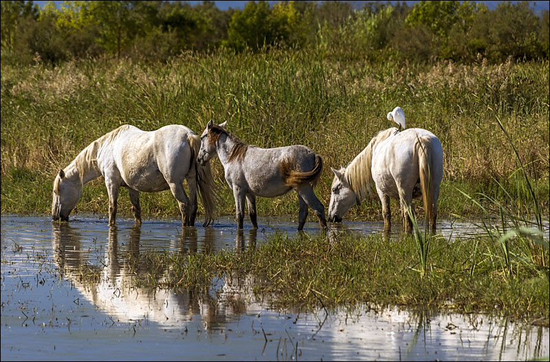
De natte Aiguamolls met paarden,
zilverreigers en flamingo's vormen de Camargue op z'n Catalaans
The Aiguamolls wetlands with horses, egrets and flamingos
are the Catalonian version of the Camargue |
 |
| |
 |
| |
 |
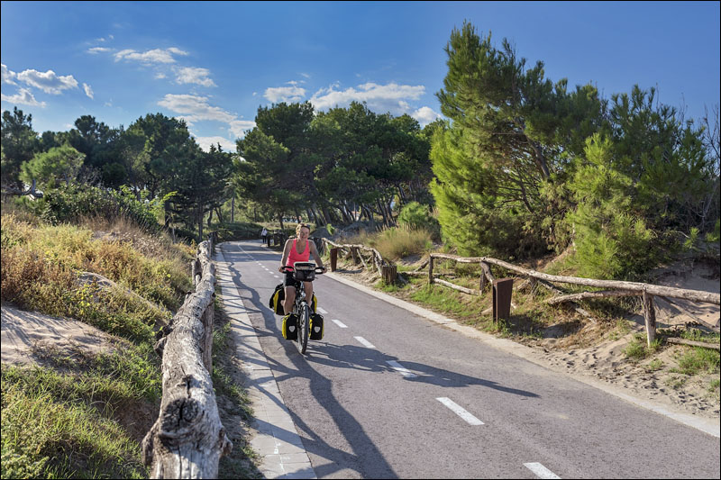
| Nazomeren op Platja d'Empuries
Indian Summer at Platja d'Empuries |
 |
| |
 |
| |
 |
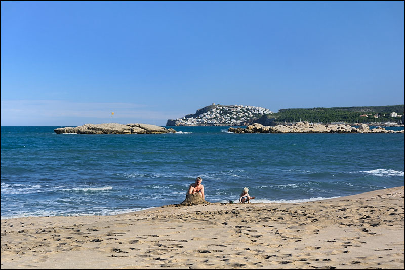
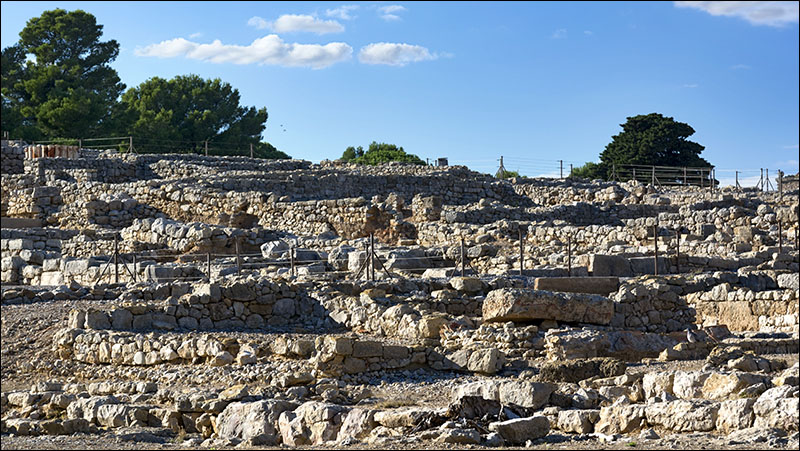
In Empúries treffen
we eeuwenoude resten van een Griekse havenstad pal naast een
gloednieuw fietspad
In Empúries we find ancient remains of a Greek
port next to a brand new cycleway |
 |
| |
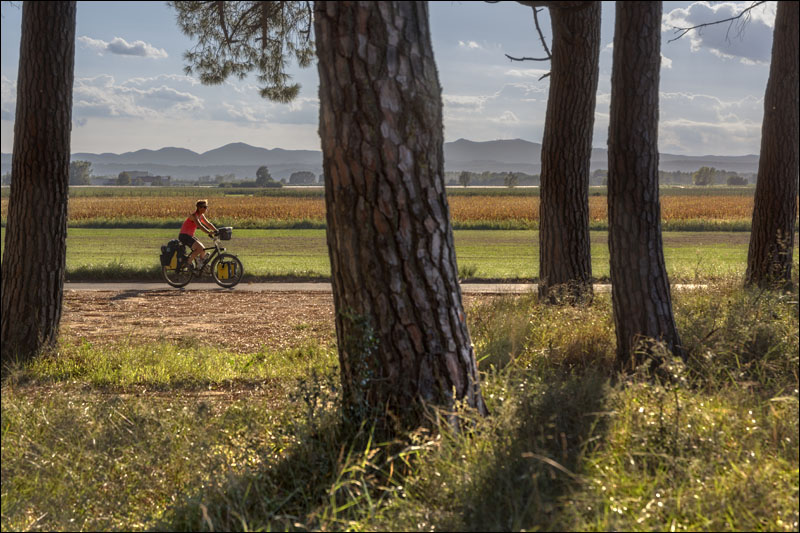 |
| Na de kust volgt een mooi stuk
Empordavlakte
After the coast we pass a nice part of the Emporda plain |
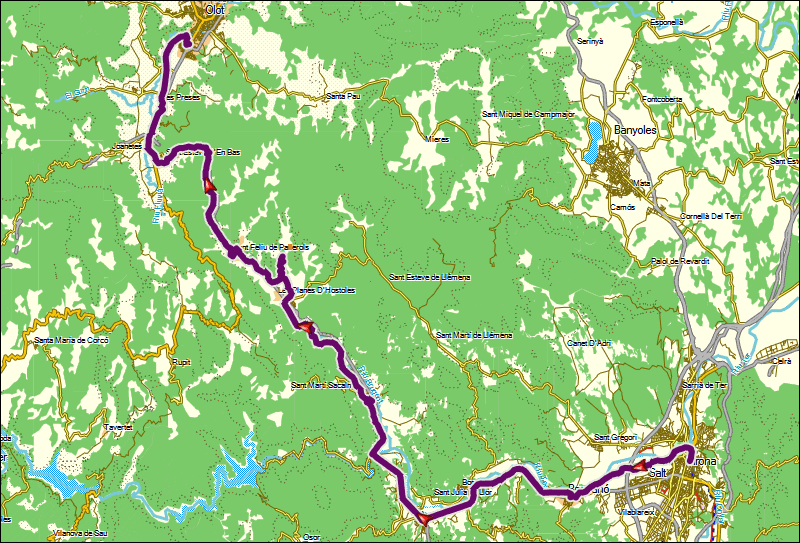
dag
3 |
van |
naar |
afstand |
netto
fietstijd
|
totale
klim
|
gemiddelde
stijging
|
wegdek |
verkeers-drukte |
08-10-13 |
Toroella
de Montgrí |
Sant
Feliu de Guixols |
55
km |
3:50
h |
335
m |
3
% |
grind + asfalt |
meestal
rustig |
day
3 |
from |
to |
distance |
moving
time |
total
ascent |
average
up-hill gradient |
road
surface |
traffic
intensity |
08-10-13 |
Toroella
de Montgrí |
Sant
Feliu de Guixols |
55
km |
3:50
h |
335
m |
3
% |
gravel + tarmac |
mostly
quiet |
|
| |
 |
| |
 |
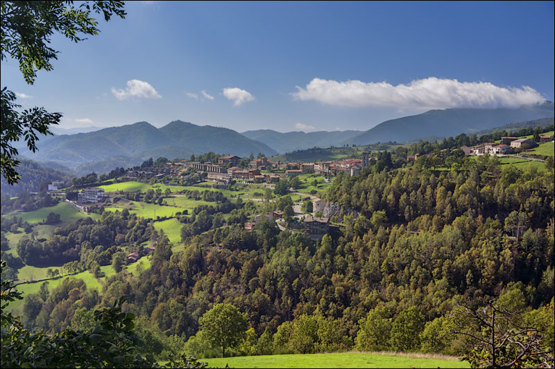
| Toroella
de Montgrí is pittoresk tot in de puntjes
Toroella de Montgrí is picturesque in every detail |
 |
| |
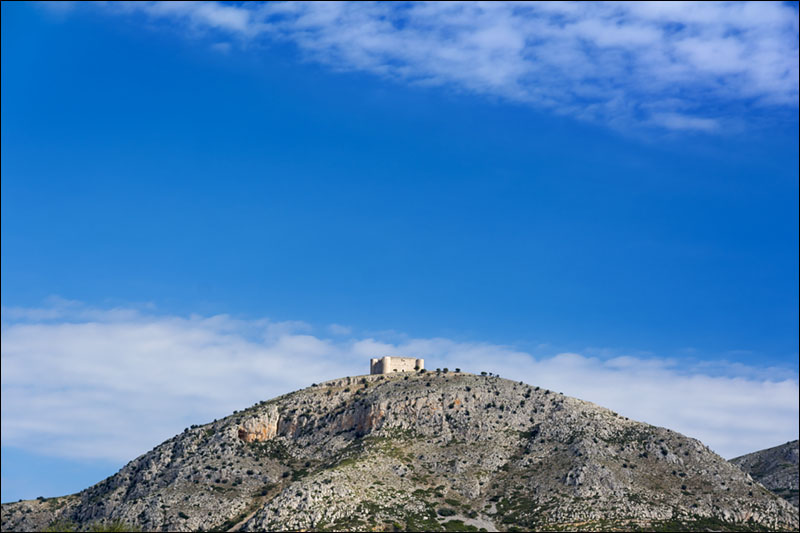 |
Het Castell del Montgrí
bezet de zuidelijkste bult van de Pyreneeën
Castell del Montgrí occupies the southernmost bump
of the Pyrenees |
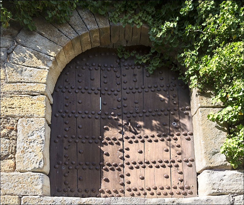 |
| Solide deuren sieren het vestingplaatsje
Pals
Solid doors decorate the fortified village of Pals |
 |
| We volgen smalle paden door
de velden
We follow narrow tracks through the fields |
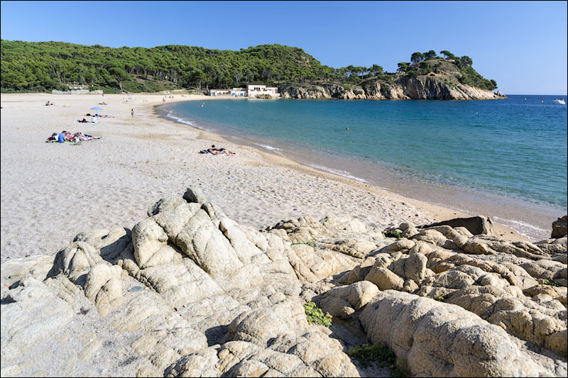 |
Platja de Castell is het grootste
onbedorven strand van de Costa Brava: alleen voor fietsers en
wandelaars
Platja de Castell is the largest unspoilt beach of the Costa
Brava: only for cyclists and pedestrians |
 |
De stranden van Palamós
en Sant Antoni de Calonge zijn een heel ander verhaal
The beaches of Palamós and Sant Antoni de Calonge
are a completely different story |
 |
| |
dag
4 |
van |
naar |
afstand |
netto
fietstijd
|
totale
klim
|
gemiddelde
stijging
|
wegdek |
verkeers-drukte |
09-10-13 |
Sant
Feliu de Guixols |
Girona |
45
km |
3:12
h |
305
m |
2
% |
meestal grind |
rustig |
day
4 |
from |
to |
distance |
moving
time |
total
ascent |
average
up-hill gradient |
road
surface |
traffic
intensity |
09-10-13 |
Sant
Feliu de Guixols |
Girona |
45
km |
3:12
h |
303
m |
3
% |
mostly gravel |
quiet |
|
| |
 |
| |
 |
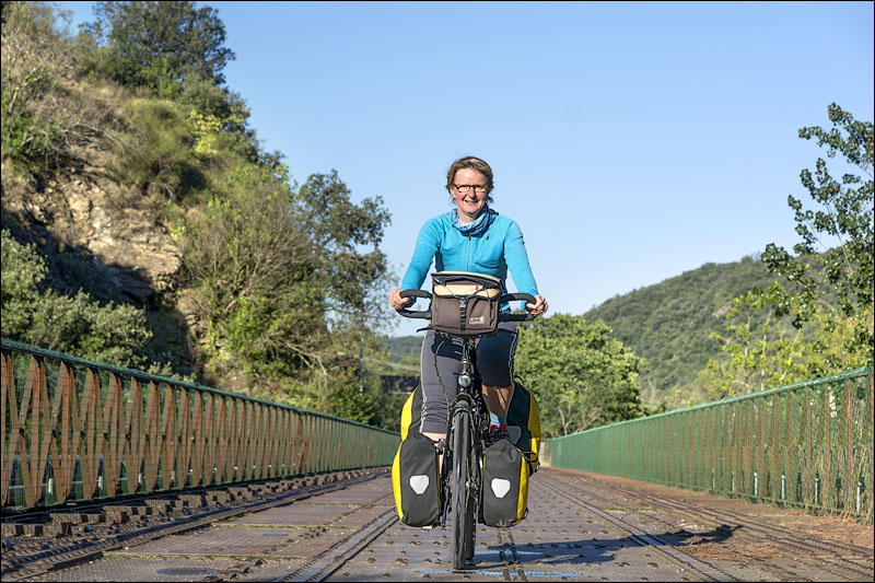
Hier begint de Ruta del Carrilet,
een tot fietspad omgebouwde spoorlijn, van de kust naar de bergen
Here the Ruta del Carrilet begins, a former railway converted
to cycle path, from the coast to the mountains |
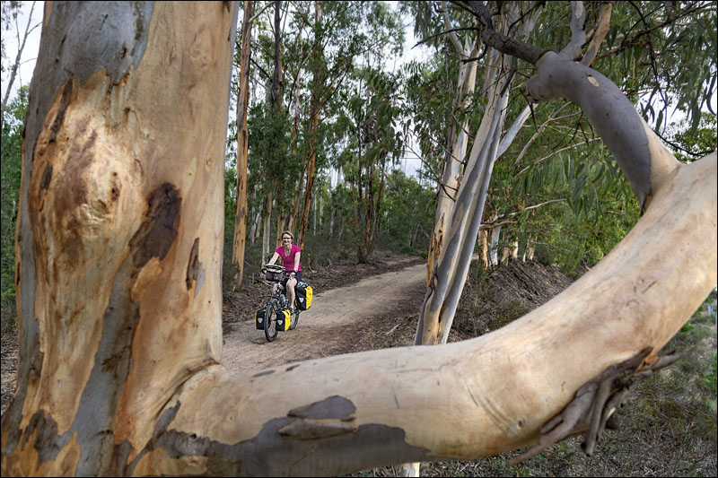 |
| Eucalyptusbomen omzomen het
pad
Eucalyptus trees fringe the path |
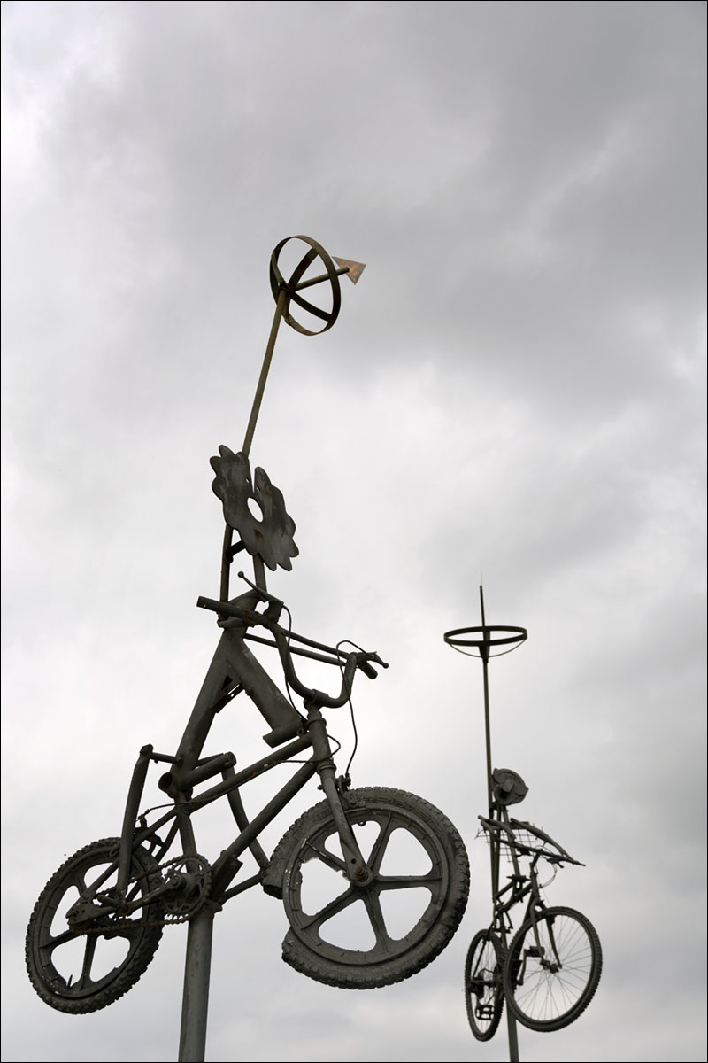 |
| Fietsen in de lucht...
Bikes in the air... |
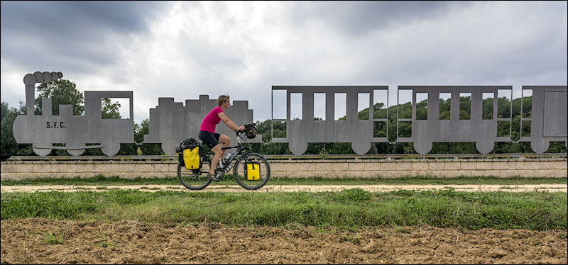 |
| ... en een trein op de grond
... and a train on the ground |
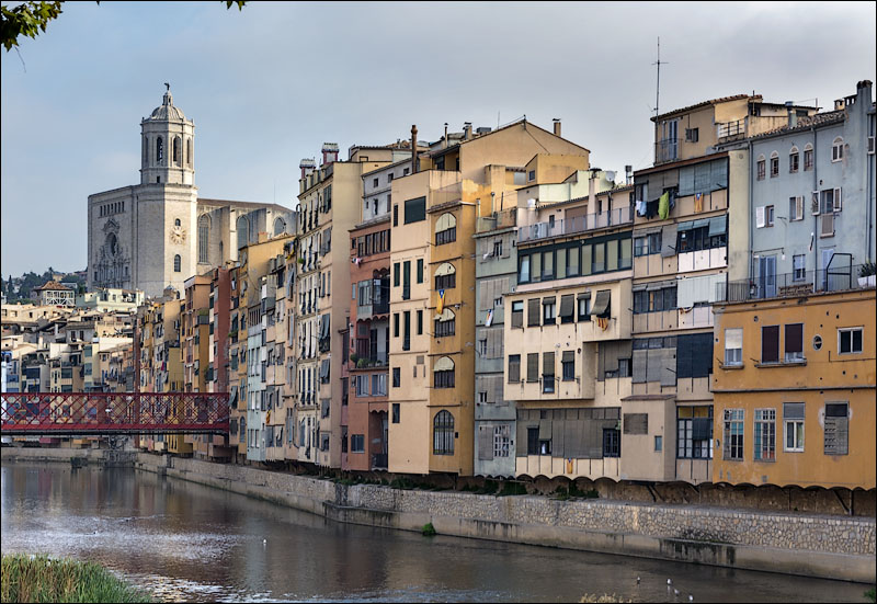 |
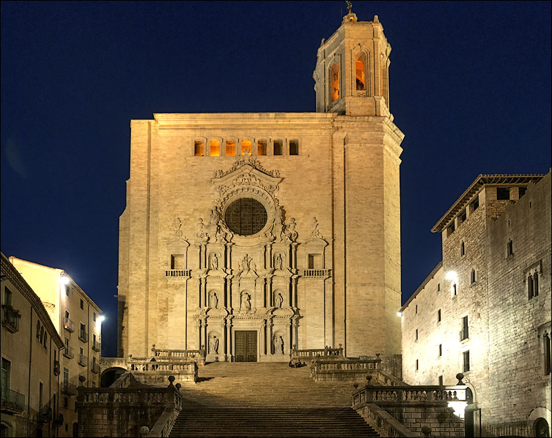
Dolen door de smalle
straatjes met middeleeuwsehuizen, staren
naar de torenhoge kathedraal en dan terecht komen in de hoek
van een pleintje met heerlijke tapas en een glas wijn: Girona
gaat niet gauw vervelen
Roaming the narrow streets with
medieval houses, staring at the towering cathedral and ending
up in the corner of a small square with delicious tapas and
a glas of wine: Girona never gets boring |
 |
| |
dag
5 |
van |
naar |
afstand |
netto
fietstijd
|
totale
klim
|
gemiddelde
stijging
|
wegdek |
verkeers-drukte |
10-10-13 |
Girona |
Olot |
65
km |
4:53
h |
705
m |
2
% |
meestal grind |
rustig |
day
5 |
from |
to |
distance |
moving
time |
total
ascent |
average
up-hill gradient |
road
surface |
traffic
intensity |
10-10-13 |
Girona |
Olot |
65
km |
4:53
h |
705
m |
2
% |
meestal grind |
quiet |
|
| |
 |
| |
 |
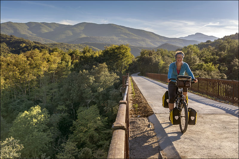
| Na Girona gaat de Ruta del Carrilet
de Pyreneeën in
After Girona the Ruta del Carrilet leads to the Pyrenees |
 |
| |
 |
| Arcades omringen het Plaça
Porxada in Amer
Arcades surround Plaça Porxada in Amer |
 |
| Het geklater van Els Gorgs
is een ommetje waard
The gurgling water of Els Gorgs is worth a small detour |
| |
dag
6 |
van |
naar |
afstand |
netto
fietstijd
|
totale
klim
|
gemiddelde
stijging
|
wegdek |
verkeers-drukte |
11-10-13 |
Olot |
Llanars |
45
km |
4:15
h |
1015
m |
4
% |
meestal asfalt |
meestal rustig |
day
6 |
from |
to |
distance |
moving
time |
total
ascent |
average
up-hill gradient |
road
surface |
traffic
intensity |
11-10-13 |
Olot |
Llanars |
45
km |
4:15
h |
1015
m |
4
% |
meestal asfalt |
mostly
quiet |
|
| |
 |
| |
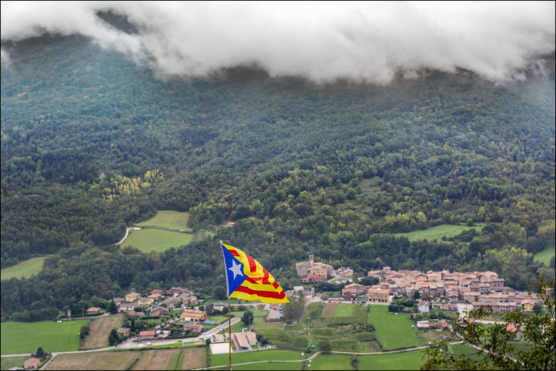 |
Wolken hangen laag rond de Coll
de Coubet en raken bijna de Catalaanse vlag
Low clouds surround the Coll de Coubet and nearly touch
the Catalan Flag |
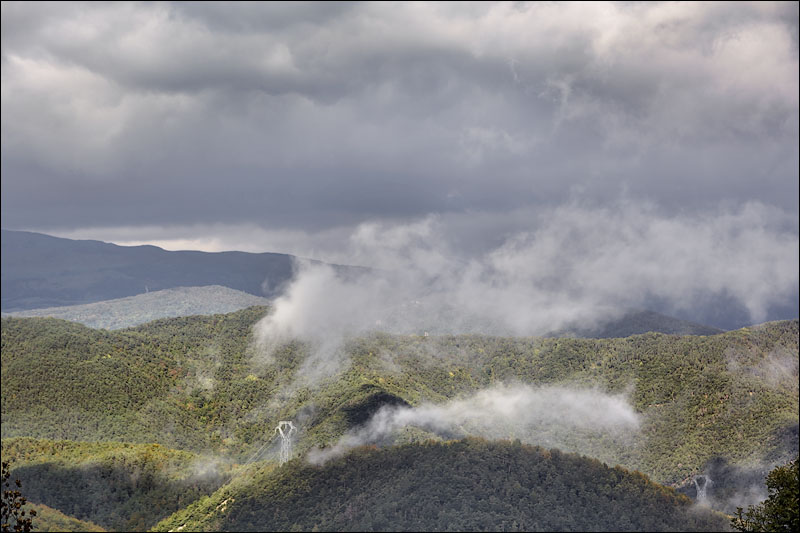 |
| Op de Coll de Santigosa priemt
de zon door de wolken
At the Coll de Santigosa the sun is piercing the clouds |
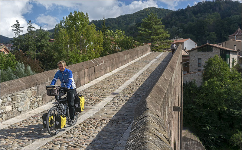 |
De middeleeuwse brug in Sant
Joan de les Abadesses doet nog altijd dienst als robuuste fietsbrug
The medieval bridge of Sant Joan de les Abadesses now serves
as a sturdy cycle bridge |
 |
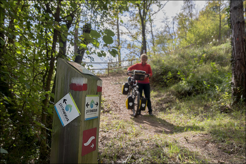
Niets mis met de bewegwijzering
hier, maar was de Pirinexus niet een fietsroute?
Pirinexus signs are excellent, but are we supposed
to cycle here? |
 |
| |
dag
7 |
van |
naar |
afstand |
netto
fietstijd
|
totale
klim
|
gemiddelde
stijging
|
wegdek |
verkeers-drukte |
12-10-13 |
Llanars |
Le
Boulou |
80
km |
5:04
h |
705
m |
3
% |
asfalt |
wisselend |
day
7 |
from |
to |
distance |
moving
time |
total
ascent |
average
up-hill gradient |
road
surface |
traffic
intensity |
12-10-13 |
Llanars |
Le
Boulou |
80
km |
5:04 |
705
m |
3
% |
tarmac |
varying |
|
| |
 |
| |
 |
| Camprodon heeft weer een monumentale
brug...
Camprodon has another monumental bridge... |
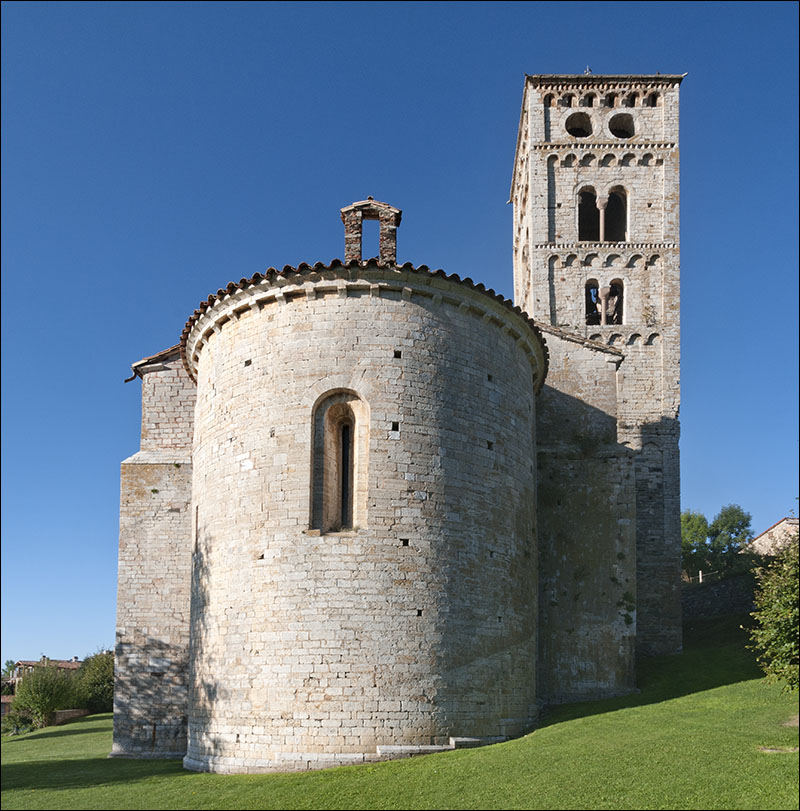 |
...en de Santa Cecília
in Mollo is een fraai voorbeeld van een Catalaans-romaanse kerk
...and the Santa Cecília in Mollo is a nice example
of a Catalan Romanesque church |
 |
| Na Mollo volgt een prachtklim
naar de Coll d`Ares
After Mollo we enjoy a great climb to the Coll d'Ares |
 |
| |
 |
| Pirinexus bordjes houden ons
letterlijk op de hoogte...
Pirinexus signs keep us aware of climbing details... |
 |
| ...maar we doen het voor
de uitzichten, niet voor de cijfertjes
...but the fun is in the views, not in the figures |
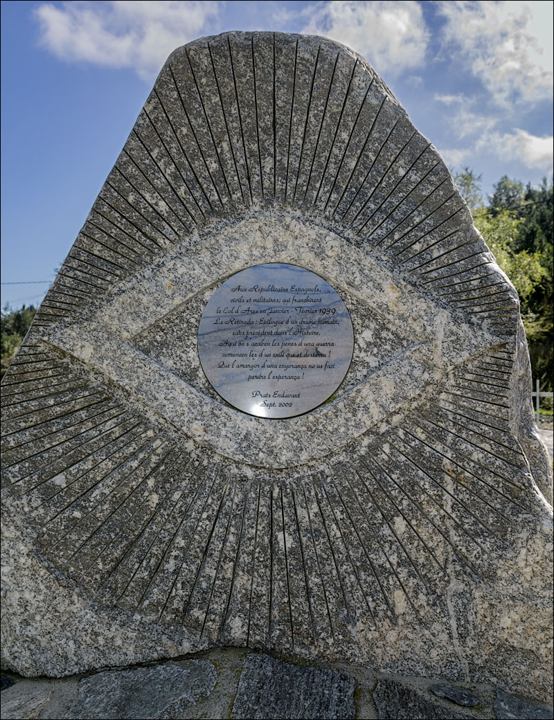 |
Op de
Coll d'Ares herinnert deze steen aan de 100 000 vluchtelingen,
die hier in de winter van 1939 de grens overstaken om
aan het Franco-regime te ontkomen
At the Coll d'Ares this stone reminds of the 100 000 refugees,
that crossed the border here in the winter of 1939 to escape
the Franco regime |
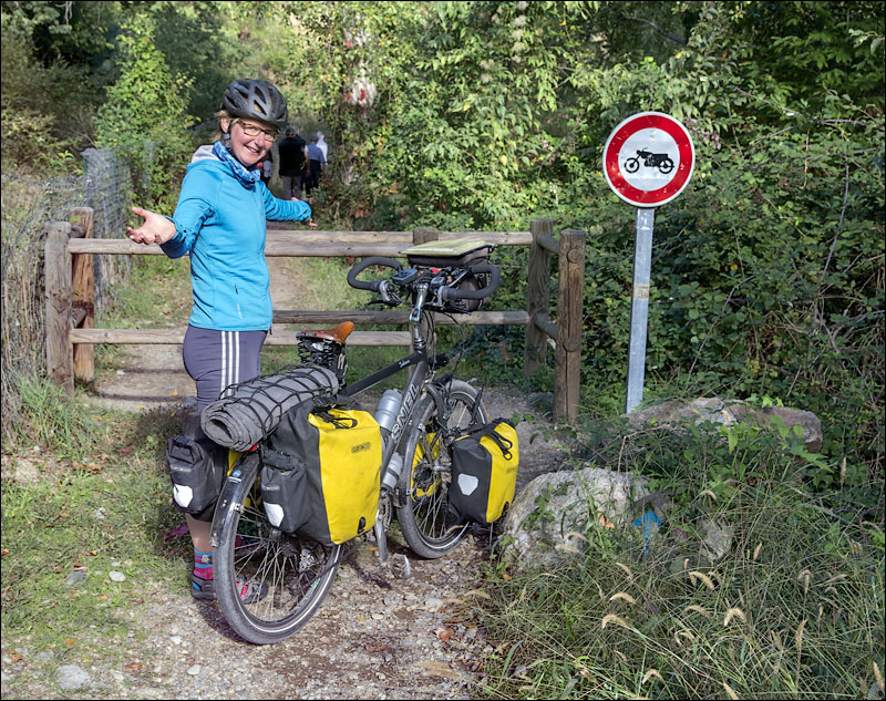 |
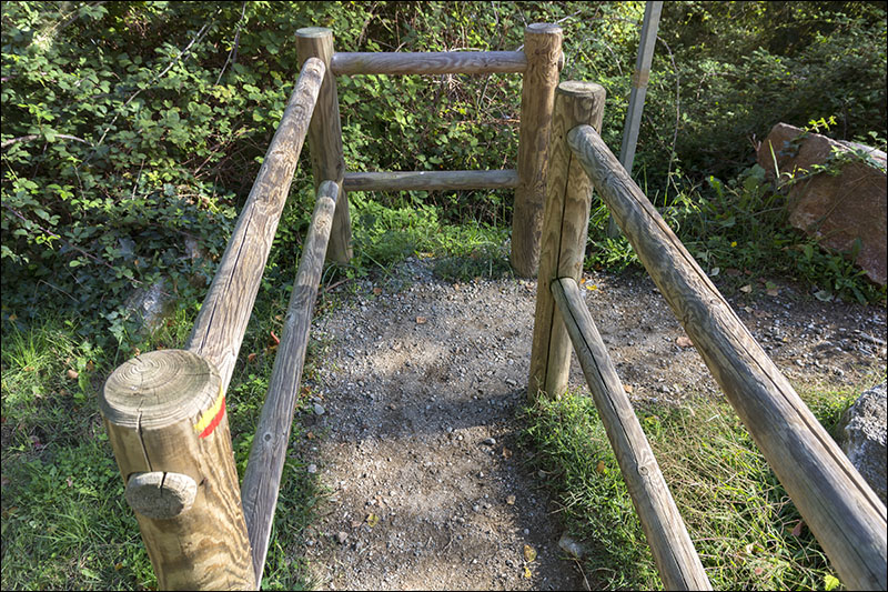
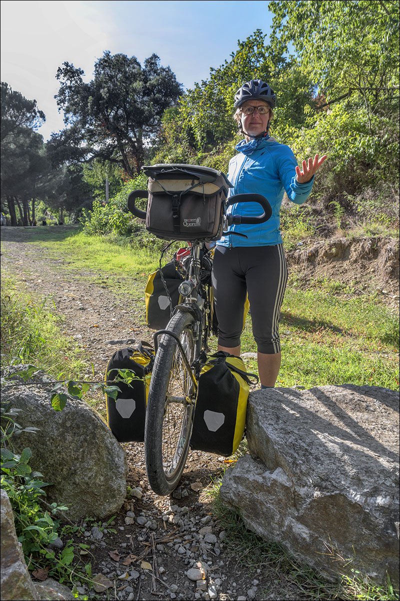
Tussen Arles-sur-Tech en Amélie-les-Bains
is de Pirinexus een voetpad, hermetisch gesloten voor brommers
... én bepakte fietsen
Between Arles-sur-Tech and Amélie-les-Bains a footpath
is used by Pirinexus, which is hermetically closed for mopeds
... and loaded bicycles as well |
 |
| |
 |
| |
 |
Na Amélie-les-Bains wordt
een oude spoorlijn in beton gegoten
After Amélie-les-Bains a disused railway is being
cast in concrete |
 |
| |
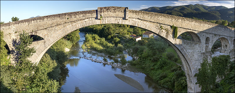 |
Bij Céret is de fietssnelweg
nog niet af, maar maken we graag gebruik van de oude Pont du
Diable
Near Céret the cycle highway is still under construction,
but here we love to use the old Pont du Diable |
| Voor meer informatie en gps-tracks van de
Pirinexus, zie www.pirinexus.cat/index.php?id=1&idioma=EN |
| For more information and Pirinexus gps-tracks,
see www.pirinexus.cat/index.php?id=1&idioma=EN |
| |